Home › Getaways › The Costa da Morte

The Costa da MorteBy carTanja Freibott — CC BY-SA 3.0 es (Wikimedia Commons)

The Costa da Morte

A Coruña, Galicia, Spain · Spain

More than a hundred kilometres of Galician coast open to the Atlantic with nothing to shelter it, and that is the reason for the name: hundreds of ships have gone down here. The Serpent in 1890 with a hundred and seventy-three dead, the HMS Captain in 1870 with four hundred and seventy-two. There are crosses along the cliffs and a cemetery out on the moor for those who reached the shore already dead. But this is also where the Roman world believed the land ended, and where pilgrims still come to see the ocean.

3 days2 nights125 km10 stopsBest season: May to September, when you are likeliest to see the sunset and the sea is less rough. But autumn and winter are when this coast explains itself best: in a storm the name makes immediate sense.

Day 1 · The end of the land

Ézaro, Corcubión and Cape Finisterre · 28 km

Ézaro waterfallTanja Freibott — CC BY-SA 3.0 es (Wikimedia Commons)

Ézaro waterfall

nature

The river Xallas drops straight into the sea from Monte Pindo, one of the very few rivers in Europe that empty like this, as a waterfall over the ocean. Behind it, the Pindo is a massif of pink granite known as the Celtic Olympus.

Tip

Note: the fall is regulated by a hydroelectric plant and does not always run. Check the release times before making the detour, because with no flow you will only see rock.

20 min to the next stop · 14 km

CorcubiónLuis Miguel Bugallo Sánchez (User:Lmbuga) — CC BY-SA 3.0 (Wikimedia Commons)

Corcubión

heritage

A seafaring town tucked at the head of its ria, with a listed historic centre and a row of grand houses with white glazed balconies looking over the harbour. It was the region's trading port back when Fisterra was only a fishing village.

Tip

It is the one stop on the route sheltered from wind and swell, because it sits at the head of the ria. A good place to eat before heading out to the open coast.

20 min to the next stop · 14 km

Cape FinisterreGrela — Public domain (Wikimedia Commons)

Cape Finisterre

history

For the Roman world, the land ended here: finis terrae. The lighthouse stands on the point, and the Camino's kilometre zero reaches it, because many pilgrims carry on this far after arriving in Santiago, looking for the ocean. Off this coast the HMS Captain went down in 1870 with four hundred and seventy-two crew: the worst shipwreck of the Costa da Morte.

Tip

The sunset from the lighthouse is what everyone comes for, and in summer you need to arrive an hour ahead to park. A serious warning: do not climb down to the rocks below. The Atlantic surges in here without warning and takes people every year.

Day 2 · The stone boat and the lace

Touriñán, Muxía and Camariñas · 49 km

Cape TouriñánBasotxerri — CC BY-SA 4.0 (Wikimedia Commons)

Cape Touriñán

viewpoints

The westernmost point of mainland Spain, further west than Fisterra, though almost nobody knows it. For a few weeks each year it is also the place on the European continent where the sun sets latest.

Tip

There is nothing built here but the lighthouse: rock, heather and wind. Which is exactly why it is usually empty while Fisterra is packed.

40 min to the next stop · 32 km

MuxíaEstevoaei — CC BY-SA 4.0 (Wikimedia Commons)

Muxía

culture

The sanctuary of the Virxe da Barca stands on the rocks, so close to the sea that the waves reach it. Legend says the Virgin appeared here in a stone boat to encourage the Apostle James, and the enormous stones beside it are, by tradition, the sail and the rudder.

Tip

Muxía and Camariñas are the two bobbin-lace towns, a craft women here still practise in their doorways. If you see someone working, look but do not photograph up close without asking.

25 min to the next stop · 17 km

CamariñasAntonio — CC BY-SA 2.0 (Wikimedia Commons)

Camariñas

culture

The town of bobbin lace, a craft said to have arrived by sea and is kept here as nowhere else in Spain: there is a museum, a school and an annual show that brings together lacemakers from across Europe. The harbour is still a working fishing port.

Tip

The lace museum is small but explains well why this is not souvenir craftwork: it was the household economy when the men went to sea and did not always come back.

Day 3 · The shipwreck route

Cape Vilán, the English Cemetery and Laxe · 48 km

Cape Vilán lighthouseEstruébanos — CC0 (Wikimedia Commons)

Cape Vilán lighthouse

history

In 1896 it became the first electric lighthouse in Spain, built after the Serpent went down close by in 1890 with almost all her crew and the tragedy caused a great stir in Britain. It stands on a hundred-and-twenty-five-metre cliff and there is a museum devoted to the shipwrecks of this coast.

Tip

It is one of the windiest spots in the peninsula: hold on along the walkway and stay away from the edge. The museum explains why this coast is called what it is called.

20 min to the next stop · 8 km

The English CemeteryMussklprozz — CC BY-SA 4.0 (Wikimedia Commons)

The English Cemetery

history

A graveyard on open ground above the Trece inlet, with no village around it. Here they buried the dead of the Serpent that the sea gave back. She was a Royal Navy cruiser that struck these rocks in November 1890: only three men survived. Inside the wall lie the captain and the officers; outside, the sailors.

Tip

You reach it by a dirt track from Cape Vilán, seven kilometres, or on foot along the PR-G 158 path. Drive slowly, and if it has rained hard consider walking instead.

25 min to the next stop · 16 km

Camelle and ArouAmadalvarez — CC BY-SA 3.0 (Wikimedia Commons)

Camelle and Arou

culture

Two tiny fishing hamlets. In Camelle, Man, a German who settled on the breakwater, lived for forty years naked and built a museum of stone sculptures facing the sea. The Prestige oil spill took it all in November 2002, and he died just a few weeks later; in the village they say it was of grief.

Tip

Part of his sculptures remain, along with a house-museum holding his work. It is a local story well known across Galicia and almost unknown outside it.

35 min to the next stop · 24 km

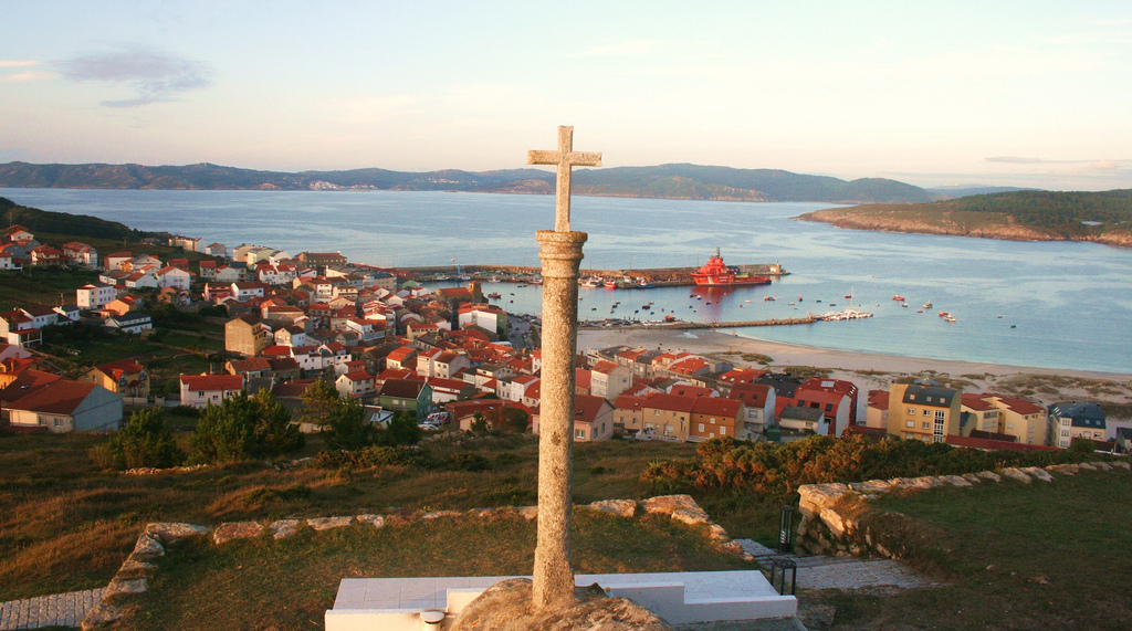
LaxeÓscar (xindilo/fotosderianxo) — CC BY-SA 2.0 (Wikimedia Commons)

Laxe

viewpoints

The end of the route and one of the widest town beaches in Galicia, with the fishing village on one side and a kilometre and a half of sand on the other. On the headland stands the chapel of Santa Rosa, and a kilometre away the Beach of Glass, covered in sea-polished glass where a dump once stood.

Tip

The Beach of Glass is the result of decades of rubbish that the Atlantic turned into something beautiful. Do not take the glass away: it is what makes the place what it is.

This getaway is in the app, day by day, with every stop on the map, the drives between them and where to sleep, and the option to save it for when there is no signal.

Open in JourGuide

Getaways